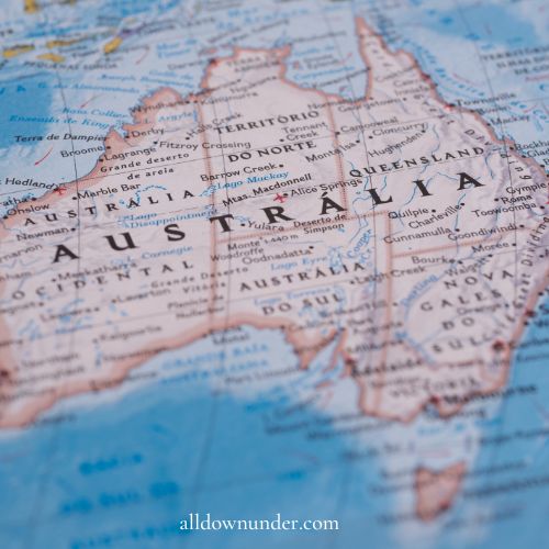
The Australian continent is made up of six states and two territories. The states are New South Wales, Queensland, Victoria, Tasmania, South Australia, Western Australia, and the Northern Territory. The territories are the Australian Capital Territory and Jervis Bay Territory.
The state is controlled under a federal system of government. The states originated as separate British colonies prior to Federation (in 1901).
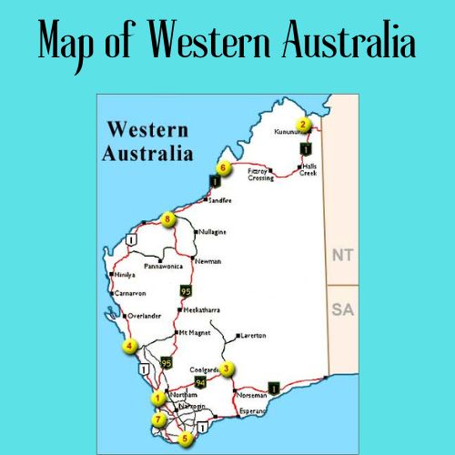
The largest State, Western Australia, is about the same size as Western Europe. The Australian mainland is the largest island and the smallest, flattest continent on Earth.
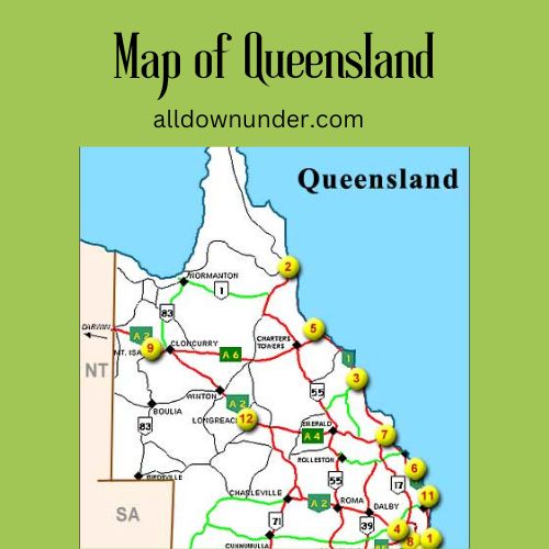
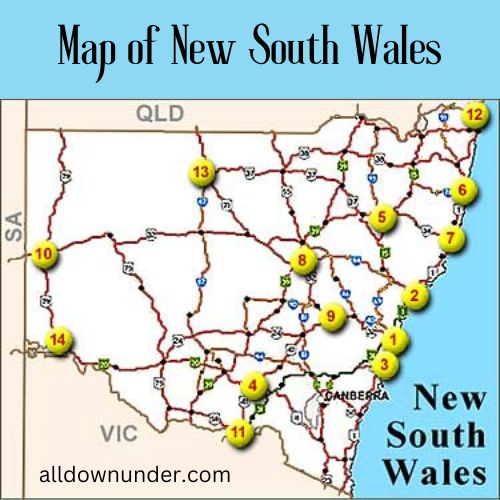
Australian Maps
See also on our website
Australian Land Facts Australian Weather for over 50 Australian cities
Australia is a wonderful travel destination with fun tourist attractions, unique Australian wildlife, breathtaking landscape, and a friendly, relaxed way of life.
Tollways are found in the eastern states of New South Wales, Victoria and Queensland. Currently all are within metropolitan areas of Sydney, Melbourne and Brisbane. Most tollways operate an open system of toll collection (tolls are collected at a barrier or mainline toll plaza). The Westlink M7 is a closed system where tolls are calculated based on distance from entry/exit points. An electronic toll collection system, known as e-TAG can be used for payment on all tollways, while some still permit payment by cash.
Australia has had three now-defunct territories in its history:
- From 1926 to 1931, the Northern Territory was divided into Central Australia and North Australia, with the border at the 20th parallel of latitude. Both territories were reincorporated as the Northern Territory at the end of this period.
- From 1949 to 1972, the Flag of Papua New Guinea Territory of Papua and New Guinea was part of Australia, remaining so until the independence of the country of Papua New Guinea.